
Choose maps around the people using them
Start with the questions staff or the public need to answer. Public safety teams may need roads and facility locations. Planning staff may need environmental context or parcel-reference information. Different audiences may need different levels of detail and different public-access rules.
Agree on sheet coverage, map scale, labels, legends, and whether users need printed pages, PDFs, editable GIS data, or a combination. A map catalog is not automatically an interactive web application or a live operational system.
Present public safety information consistently
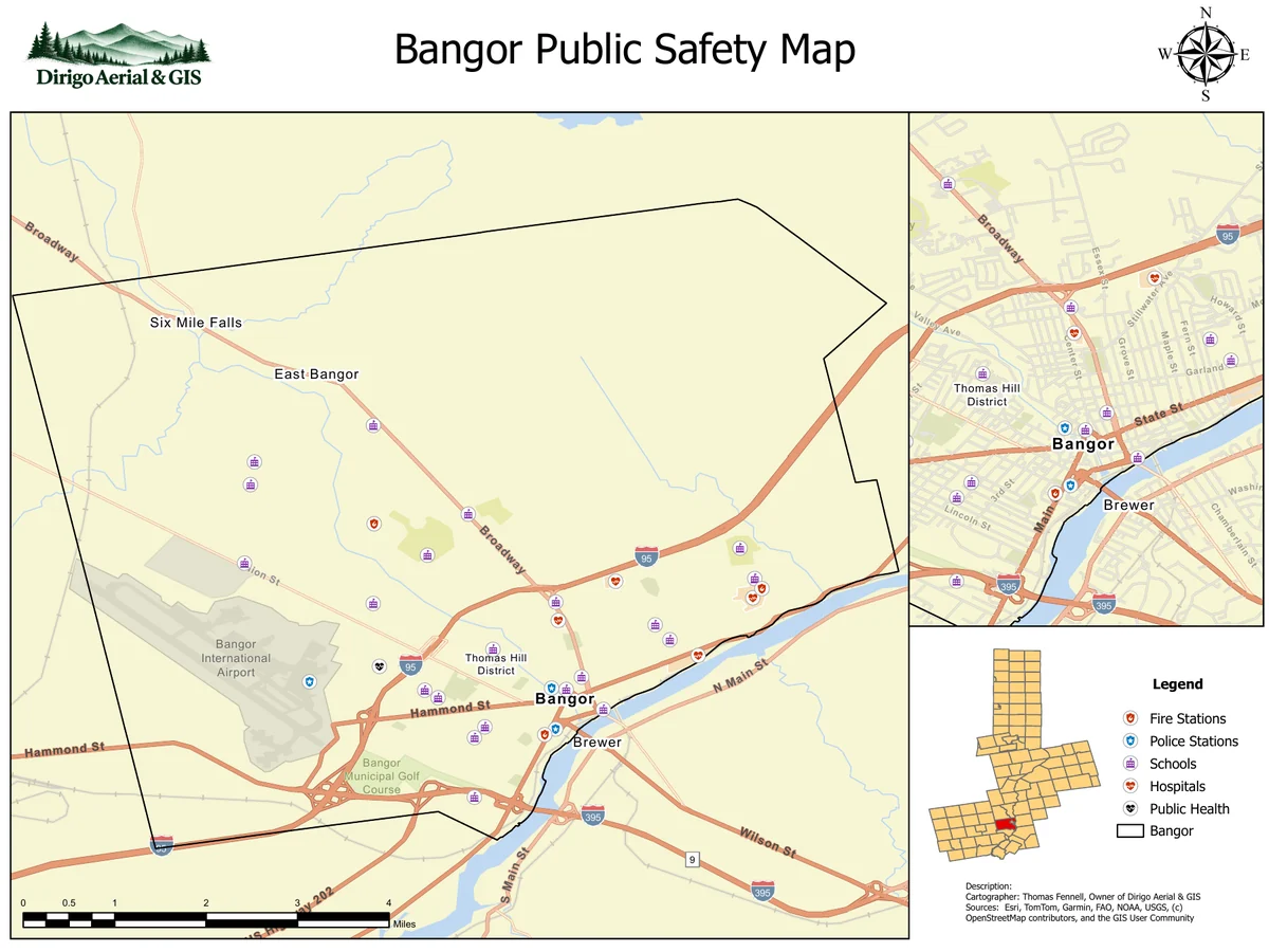
The Bangor portfolio example brings roads, community facilities, map insets, and a legend into one layout. Consistent symbols and sheet design help users understand what is being shown and find the relevant part of the map.
Confirm facility locations, names, road information, and update dates with the responsible data owners. A polished layout does not establish that every source feature is current. Any operational use needs review appropriate to that use.
Combine environmental and reference layers carefully
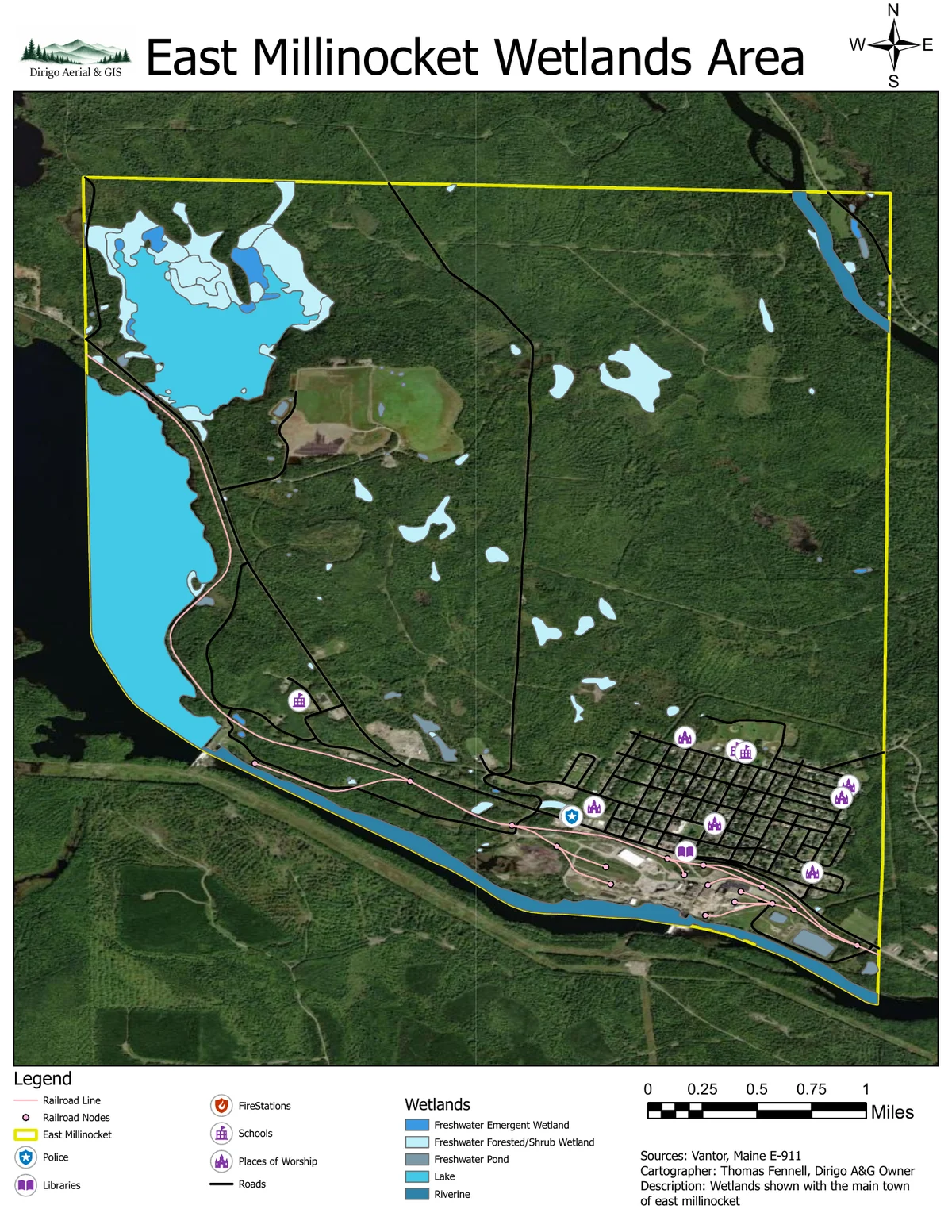
GIS can bring mapped wetlands, roads, community features, imagery, or other relevant layers into a common view. Each layer needs appropriate documentation, including its source, collection or update date, coordinate reference, and limitations.
Digitizing a tax map preserves and organizes its mapped information; it does not make that information more accurate than its source or establish a surveyed boundary. Likewise, an inventory wetland layer should not be treated as a field-verified delineation.
View Combine environmental and reference layers carefully (PDF)
Plan the handover and future updates
For a quote, send the town or project area, the intended users, your available maps or files, required outputs, and timeline. Include the GIS software your team uses and any information that should not appear in public versions.
Agree on who will maintain the data and how revised sheets will be issued. Clear file names, dates, source notes, and an update process help keep a catalog useful after its first delivery. GIS tutoring can also help staff understand a particular tool or the broader workflow.