Colorized LiDAR point cloud showing trees, buildings, a road and overhead utility lines

Capabilities

LiDAR capture

Dense elevation data that reveals terrain, canopy structure, and surface conditions for land classification and height models.

Selected work

LiDAR capture examples

Penobscot County

320 Acre forestry lot

The client requested a canopy height model, a digital elevation model (DEM), and aerial imagery of the property. An aerial survey was completed to collect the raw data and produce the requested deliverables.

View 320 Acre forestry lot in the portfolio
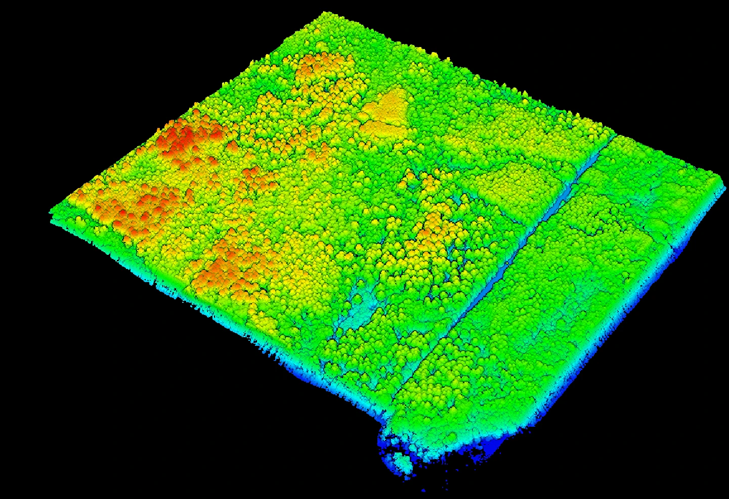
Old town ME

200 Acre Lot

Flew lidar over part of the University forest in Old Town Maine to test the capabilities of our M400 and L3 sensor.

Using an DRTK3 as my base station allowing me to acquire a 3 cm accuracy for both horizontal and vertical. Using 6 checkpoints as my accuracy checks

200 Acre Lot View 200 Acre Lot in the portfolio

Questions and answers

Frequently asked questions

How does drone LiDAR measure stockpile volumes and cut-and-fill quantities?

Drone LiDAR measures surface elevations that can be used to calculate stockpile volume above an agreed base surface. Comparing existing and proposed surfaces can also support cut-and-fill estimates. The calculation requires defined boundaries, compatible units, and a suitable reference surface. Results describe volume, not weight; estimating tonnage additionally requires appropriate material-density information.

How accurate are LiDAR stockpile volume measurements?

LiDAR stockpile volume accuracy depends on the measured surface, point classification, pile boundaries, and the assumed base beneath the material. Vegetation, obstructed edges, or an uncertain base can change the estimate. Centimeter-level point-position accuracy does not automatically translate into a fixed percentage of volume accuracy. The checking method and acceptable uncertainty should be agreed upon for the project.

Can drone LiDAR measure tree height and forest canopy height?

Yes. Drone LiDAR can support tree-height estimates and canopy height models by comparing vegetation elevations with a ground model. The result describes height above local ground, not elevation above sea level. Reliability depends on treetop and ground coverage, vegetation conditions, point density, and classification. Individual tree measurements and broader canopy mapping require different collection and analysis choices.

What mapping accuracy can the DJI Zenmuse L3 achieve?

DJI specifies Zenmuse L3 point-cloud accuracy of 3 cm vertical RMSE and 4 cm horizontal RMSE at a 120 m flight altitude under defined laboratory conditions. Its tests used a position-calibrated D-RTK 3 station, specified flight and calibration settings, exposed hard-surface checkpoints, and DJI Terra processing settings. RMSE is a statistical error measure, not a maximum error for every point. These specifications are not a guarantee for each site; project accuracy requires appropriate independent checks.

What LiDAR mapping deliverables can I receive?

LiDAR mapping deliverables can include point clouds, digital elevation models, contours, canopy height models, three-dimensional models, and material-volume calculations, depending on the agreed scope. The right combination depends on your project goals. Before collection, we confirm the outputs, file formats, coordinate references, units, and accuracy requirements relevant to their intended use.

Can repeat LiDAR mapping track terrain and stockpile volume changes?

Yes. Comparing LiDAR surfaces from different dates can help quantify terrain changes or changes in stockpile volumes. Reliable comparisons require compatible coordinate systems and vertical references, consistent boundaries, and suitable surface quality. Changes must be evaluated against the uncertainty of both datasets; small differences may reflect measurement uncertainty rather than actual site changes.

Contact us

Tell us about your project

Looking for LiDAR, aerial imagery, or GIS support? Tell us where your project is, what you need to understand, and your ideal timeline.